News
2022年07月29日
【Press Release】Beta Version of Climate Vision, a Cutting-edge Scientific Solution for Sustainability Information Disclosure, Released
Web application to analyze physical risks such as floods intensifying due to climate change
Gaia Vision, Inc. (Headquarters: Shibuya-ku, Tokyo, Representative Director: Yuki Kita) is pleased to announce that it will start offering a beta version of “Climate Vision,” a web application that can easily analyze flood risks required for climate change response and sustainability information disclosure, from August 1, 2022.
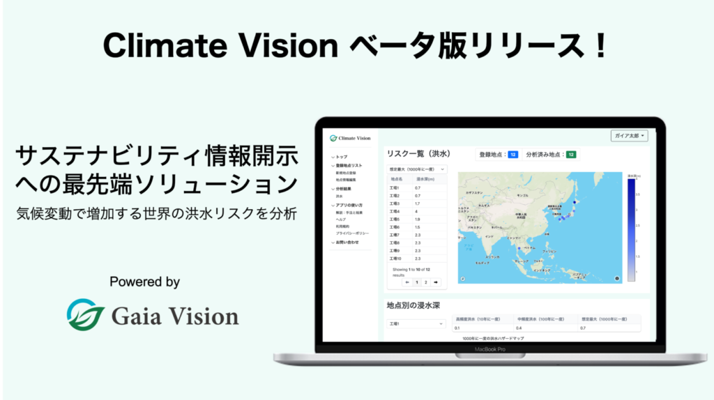
■ Features of Climate Vision
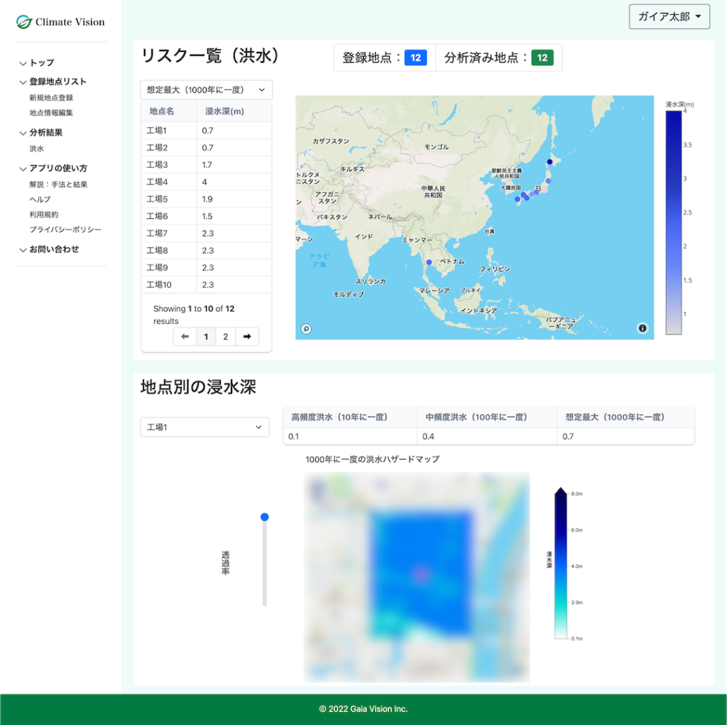
Climate Vision (beta) provides global flood risk information calculated based on historical climate data. This information was developed based on high-precision data created by Gaia Vision using the research results of the University of Tokyo, etc. and intellectual property, Japan and boasts a high resolution of 30 m in Japan and 90 m in other countries. It can be easily operated and analyzed in a web application based on easy-to-understand GIS (Geographic Information System), and can be used by the person in charge of sustainability at companies and financial institutions who are the intended users to respond to sustainability information disclosure such as TCFD and CDP.
■ Background of development
The impact of climate change is increasing natural disasters such as floods around the world, and there is concern around the world that disaster risk may increase in the future. Given the strong demand from financial institutions and other organizations for corporate risk management and disclosure of information on climate risks, Gaia Vision has continued to develop tools that can easily analyze flood risk, which is one of the largest types of damage among climate physical risks. In order to make it available to people in charge of companies and financial institutions as soon as possible, we have decided to release it in beta version. We will continue to develop to expand our functions.
■ How to use Climate Vision
1. Specify the latitude and longitude of the point to be analyzed from the registered
address and easily register the point you want to analyze. It is also possible to upload a CSV file and register multiple locations at once.
2. Run AnalysisAnalysis
Analysis can be easily performed with the push of a button. Your price is determined based on the number of locations you want to analyze.
3. Display/download results on map
The analysis allows you to display the flood risk value at that point on a map and in a table. We also provide flood risk data around the location.
■ Future developmentOnly
some functions and data are implemented in the current beta version, and we plan to release it in the autumn or so. In addition to floods, we will continue research and development on other climate-related risks such as storm surges, heat waves, and water resources, and strive to contribute to the improvement of climate risk management and sustainability for companies, financial institutions, and local governments.
[Contact]
Please contact us through the HP contact form.
https://www.gaia-vision.co.jp/#link_contact
News
- 2025年12月16日 Gaia Vision Selected for a JICA Demonstration Project on Digital and Space Technologies for Water Resources Management
- 2025年09月01日 Our two speakers, Kita and Demoto, will be present at the talk session on September 20 at Expo 2025 in Osaka/Kansai.
- 2025年04月03日 Our technology development project as a partner organization was selected for the “Overseas Demonstration of Satellite Data Application Systems (Feasibility Study),” a technology development theme for which the Space Strategic Fund is soliciting applications from the public.
- 2025年03月07日 ADRC (Asian Disaster Reduction Center) Researchers from Asian Countries Visited Our Company
- 2025年02月21日 ADRC (Asian Disaster Reduction Center) Researchers from Asian Countries Visited Our Company
Column
-
-
-
-
-